
Robohub.org
Robocars driving when the map is wrong
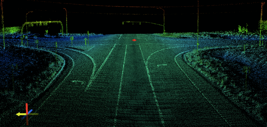
photo: http://blog.udot.utah.gov/
Yesterday’s note on Here’s maps brought up the question of the wisdom of map-based driving. While I addressed this a bit earlier let me add a bit more detail.
A common first intuition is that because people are able to drive just fine on a road they have never seen before that this is how robots will do it. They are bothered that present designs instead create a super-detailed map of the road by having human driven cars scan the road with sensors in advance. After all, the geometry of the road can change due to construction; what happens then?
They hope for a car that, like a human, can build its model of the road in real time while driving the road for the first time. That would be nice, of course, and gives you a car that can drive most roads right away, without needing to map them. But it’s a much harder problem to solve, and unlikely to ever be solved perfectly. Car companies are building very simple systems which can follow the lines on a freeway under human supervision without need for a map. But real city streets are a different story.
The first thing to realize is that any system which could build the correct model as you drive is a system that could build a map with no human oversight, so the situations are related. But building a map in advance is always going to have several very large advantages:
- You build the map from not just one scan of the road, but several, and done in different lanes and directions. As a result, you get 3-D scans of everything from different angles, and can build a superior model of the world.
- Using multiple scans lets you learn about things that are stationary but move one day to the next, like parked cars.
- You can process the data using a cloud supercomputer in as much time, memory and data storage as you want. Your computer is effectively thousands of times more capable.
- Humans can review the map built by the software if there’s anything it is uncertain about (or even if there is nothing) at their leisure.
- Humans can also test the result of the automatic and guided mapping to assure accuracy with one extra drive down the road.
In turn there are disadvantages
- At times, such as construction, the road will have changed from when it was mapped
- This process costs effort, and so the vehicle either does not drive off the map, or only handles a more limited set of simpler roads off the map.
The advantages are so great that even if you did have a system which could handle itself without a map, it is still always going to be able to do better
with a map. Even with a great independent system you would want to make an effort to map the most popular roads and the most complex roads, up to the limit of your budget. The cost is an issue, but the cost of mapping roads is nothing compared to the cost of building or maintaining them. It’s a few times driving down the road, and some medium-skilled labour.

The road has changed
Let’s get to the big issue — the map is wrong, usually because construction has changed it.
First of all, we must understand that the sensors always disagree with the map, because the sensors are showing all the other cars and pedestrians etc. Any car has to be able to perceive these and drive so as not to hit them. If a traffic cone, “road closed” sign or flagman appears in the road, a car is not going to just plow into them because they are not on the map! The car already knows where not to go, the question is where it should go when the lanes have changed.
Even vehicles not rated to drive any road without a map can probably still do basic navigation and stay within their lane markers without a map. For the 10,000 miles of driving you do in a year, you need a car that does that 99.99999% of the time (for which you want a map) but it may be acceptable to have a car that’s only 99.9% able to do that for the occasional mile of restriped road. Indeed, when there are other, human-driven cars on the road, a very good strategy is just to follow them — follow one in front, and watch cars to the side. If the car has a clear path following new lane markers or other cars, it can do so.
Google, for example, has shown videos of their vehicle detecting traffic cones and changing lanes to obey the cones. That’s today — it is only going to get better at this.
But not all the time. There will be times when the lanes are unclear (sometimes the old lanes are still visible or the new ones are not well marked.) If there are no other cars to follow, there are also no other cars to hit, and no other traffic to block.
Still, there will be times when the car is not sure of where to go, and will need help. Of course, if there is a passenger in the car, as there would be most of the time, that passenger can help. They don’t need to be a licenced driver, they just need to be somebody who can point on the screen and tell the car which of the possible paths it is considering is the right one. Or guide it with something like a joystick — not physically driving but just guiding the car as to where to go, where to turn.
If the car is empty, and has a network connection, it can send a picture, 3-D scan and low-res video to a remote help station, where a person can draw a path for the car to go for its next 100 meters, and keep doing that. Not steering the car but helping it solve the problem of “where is my lane?” The car will be cautious and stop or pull over for any situation where it is not sure of where to go, and the human just helps it get over that, and confirms where it is safe to go.
If the car is unmanned and has no network connection of any kind, and can’t figure out the road, then it will pull over, or worst case, stop and wait for a human to come and help. Is that acceptable? Turns out it probably is, due to one big factor:
This only applies to the first car to encounter an unplanned, unreported construction zone
We all drive construction zones every day. But it’s much more rare that we are the first car to drive the construction zone as they are setting it up. And most of the rules I describe above are only for the first connected car to encounter a surprise change to the road. In other words, it’s not going to happen very often. Once a car encounters a surprise change to the road, it will report the problem with the map. Immediately all other cars will know about the zone.
If that first car is able to navigate the new zone, it will be scanning it with sensors, and uploading that data, where a crew can quickly build a corrected map. Within a few minutes, the map and the road will no longer differ. And that first car will be able to navigate the new zone 99.999% of the time — either because it has a human on board, remote human help or it’s a simple enough change that the car is able to drive it with an incorrect map.
In addition, the construction zone has to be a surprise. That means that, in spite of regulations, the construction crews did not log plans for it in the appropriate databases. Today that happens fairly often, but over time it’s going to happen less. In fact, there are plans to have transponders on construction equipment and even traffic cones that make it impossible to create a new construction zone without it showing up in the databases. Setting up a road change has a lot of strongly enforced safety rules, and I predict we’ll see “Get out your smartphone and make sure the zone is in the database before you create it” as one of them, especially since that’s so easy to do.
(You have probably also seen that tools like Waze, driven by ordinary human driver smartphones, are already mapping all the construction zones when they pop up.)
If a complex zone is present and unmapped, unmanned cars just won’t route through there until the map is updated. The more important the zone, the more quickly it will get updated. If need be, a mapping worker will go out in a car before work even begins. If a plan was filed, we’ll also know the plan for the zone, and whether cars can handle it with an old map or not.
Most of the time, though, a human passenger will be there to guide the car through the zone. Not to steer — there may not be a steering wheel — but to guide. The car will go slowly and stay safe.
Once a car is through, it will send the scans up to the mapping center, and all future cars will have a map to guide them until the crew changes the road again without logging it. I believe that doing so should be made against safety regulations, and be quite rare.
So look at those numbers. I will hope it’s reasonable to expect that 99% of construction zones will be logged in road authority databases before they begin. Of the 1% that aren’t, there will be a first robocar to encounter the zone. 90% of the time that car will have a passenger able to help. For the 10% unmanned cars, I predict a data network will be available 99% of the time. (Some would argue 100% of the time because unmanned cars will just not go where there is not a data connection, and we may also get new data services like Google’s Loon, or Facebook’s drone program to assure coverage everywhere.)
So now we are looking at one construction zone in 100,000 where there was no warning, there is no human, and there is no data. But we’ve rated are car as able to handle handle off-map driving 99.9% of the time. For the other .1%, it decides it can’t see a clear path, and pulls over. When it doesn’t report back in on the other side of the data dead zone, a service vehicle is dispatched and fixes the problem.
So now in one in 100,000,000 construction zones, we have a car deciding to pull over. Perhaps for half of those, it can’t figure out how to pull over, and it stops in the lane. Not great — but this is one in 200 million construction zones. In other words, it happens with much less frequency than accidents or stalled cars. And there is even a solution. If a construction worker flashes an ID card at the car’s camera when it’s in a confused state, the car can then follow that worker to a place to stop. In fact, since the confused state is so rare, there is probably not even a need for an ID card. Just walk up, make a “follow me” gesture and walk the car where it needs to go.
Tweak these numbers as you like. Perhaps you think there will be far more construction zones not logged in databases. Perhaps you think the car’s ability to drive a changed zone will only be 50%. Perhaps you think there will still be lots of unmanned cars running in wireless dead zones in 2020. Even so the number of cars that stop and give up will still be far fewer than the number of cars that block roads today due to accidents and mechanical problems. In other words, no big whoop.
It’s important to realize that unmanned cars are not in a hurry. They can avoid zones they are not comfortable with. If they can’t get through at all, the taxi company sending the car can just send another from a different direction in almost all cases.
It’s also important to realize that cars in an uncertain situation are also not in a big hurry. They will slow until they can be sure they are safe and able to handle the road. Slow, it turns out, is easy. Slow and heavy traffic (ie. a traffic jam) is actually also very easy — you don’t even need to see the lines on the road to handle that one; you usually can’t.
Once again this is only for the first car to encounter the surprise zone. Much more common will be a car that is the first to encounter a planned zone. This car will always have a competent passenger, because the service will not direct an unmanned car into an unknown construction zone where there is no data. This passenger will get plenty of warning, and their car may well pull over so there is no transition from full-auto to semi-auto while the car is moving. Then this person will guide the car through the zone at reduced speed. Probably just with a joystick, though possibly there will handlebars that can pop out or plug in if true semi-manual driving is needed.
New road signs
Road signs are a different problem. Already there are very decent systems for recognizing road signs captured by the camera — systems that actually do better at it than human beings. But sometimes there are road signs with text, and the system may recognize them, but not understand them. Here again we may call upon human beings, either in the vehicle, or available via a data connection. Once again, this is only for the first unmanned car to encounter the new road sign.
I will propose something stronger, though. I believe there should be a government mandated database of all road signs. Further, I believe the law should say that no road sign has legal effect until it is entered in the database. Ie. if you put up a sign with a new speed limit, it is not a violation of the limit to ignore the sign until the sign is in the database. At least not for robots. Once again, all this needs is that the crews putting in the signs have smartphones so they can plonk the sign on the map and enter what it is.
We may never need this, though, because the ability of computers to read signs is getting very good. It may be faster to just make it even better than to wait for a law that mandates the database. With a 3-D map, you will never miss a brand new sign, but you might get confused by a changed sign — you will know it changed but may need to ask for help to understand it if it is non-standard. There are already laws that standardize road signs, but only to a limited extent. Even so, the number of sign styles in any given country is still a very manageable number.
Random road events
Sometimes driving geometry changes not due to construction, but due to accidents and the environment. Trees get knocked down. Roads flood. Power lines may fall. The trees will be readily seen, and for the first car to come to a fallen tree, the procedure will be similar, though in a low traffic area the vehicles will be programmed to go around them, as they are for stalled cars and slow moving vehicles. Flooding and power lines are more challenging because they are harder to see. Flooding, of course, does not happen by surprise. That there is flooding in a region will be well known so cars will be on the lookout for it. Human guides will again be key.
A plane is not a bird
Aircraft do not fly by flapping their wings, and robocars will not see the world as people do nor drive as they do. When they have accurate maps, it gives us much more confidence in their safety, particularly the ability to pick the right path reliably at speed. But they have a number of tools open to them for driving a road that doesn’t match the map precisely without needing to have the ability to drive unmapped roads 99.999999% of the time. That’s a human level ability and they don’t need it.
A version of this article originally appeared on robocars.com.
tags: Automotive, Autonomous Cars, robocars, self-driving cars

AUAI is supported by:


