Robohub.org
Agricultural drone investing | Energy and Capital
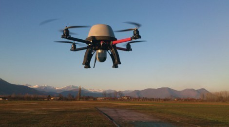
“Although farms used to be small enough in size for human and ground-based surveillance, consolidation has led to massive fields that cannot be traversed by land in a timely manner. Instead, farmers now need to view their land from the sky. This point of view can be obtained with satellite imaging, planes, or helicopters. However, these methods provide low resolution images and are very expensive. Autonomous imaging drones offer a better service at a cheaper price, which is exactly why the AUVSI expects precision agriculture to see substantial growth in the next two decades.”
See on www.energyandcapital.com
John Payne
Related posts :
Sven Koenig wins the 2026 ACM/SIGAI Autonomous Agents Research Award
AIhub
10 Feb 2026
Sven honoured for his work on AI planning and search.
Robot Talk Episode 143 – Robots for children, with Elmira Yadollahi
Robot Talk
06 Feb 2026
In the latest episode of the Robot Talk podcast, Claire chatted to Elmira Yadollahi from Lancaster University about how children interact with and relate to robots.
New frontiers in robotics at CES 2026
Henry Hickson
03 Feb 2026
Henry Hickson reports on the exciting developments in robotics at Consumer Electronics Show 2026.
Robot Talk Episode 142 – Collaborative robot arms, with Mark Gray
Robot Talk
30 Jan 2026
In the latest episode of the Robot Talk podcast, Claire chatted to Mark Gray from Universal Robots about their lightweight robotic arms that work alongside humans.
Robot Talk Episode 141 – Our relationship with robot swarms, with Razanne Abu-Aisheh
Robot Talk
23 Jan 2026
In the latest episode of the Robot Talk podcast, Claire chatted to Razanne Abu-Aisheh from the University of Bristol about how people feel about interacting with robot swarms.
Vine-inspired robotic gripper gently lifts heavy and fragile objects
MIT News
23 Jan 2026
The new design could be adapted to assist the elderly, sort warehouse products, or unload heavy cargo.
Robot Talk Episode 140 – Robot balance and agility, with Amir Patel
Robot Talk
16 Jan 2026
In the latest episode of the Robot Talk podcast, Claire chatted to Amir Patel from University College London about designing robots with the agility and manoeuvrability of a cheetah.
Taking humanoid soccer to the next level: An interview with RoboCup trustee Alessandra Rossi
AIhub and Lucy Smith
14 Jan 2026
Find out more about the forthcoming changes to the RoboCup soccer leagues.


